GIS影像
GIS 影像组件是鲸孪生内部的组件之一,需要手动添加,可以删除。每一个鲸孪生组件可以添加多个 GIS 影像,并且添加后的 GIS 影像能够完美与整个数字孪生系统进行融合。下面为大家介绍一下如何在山海鲸可视化中 GIS 影像的设置。
1. 影像的添加
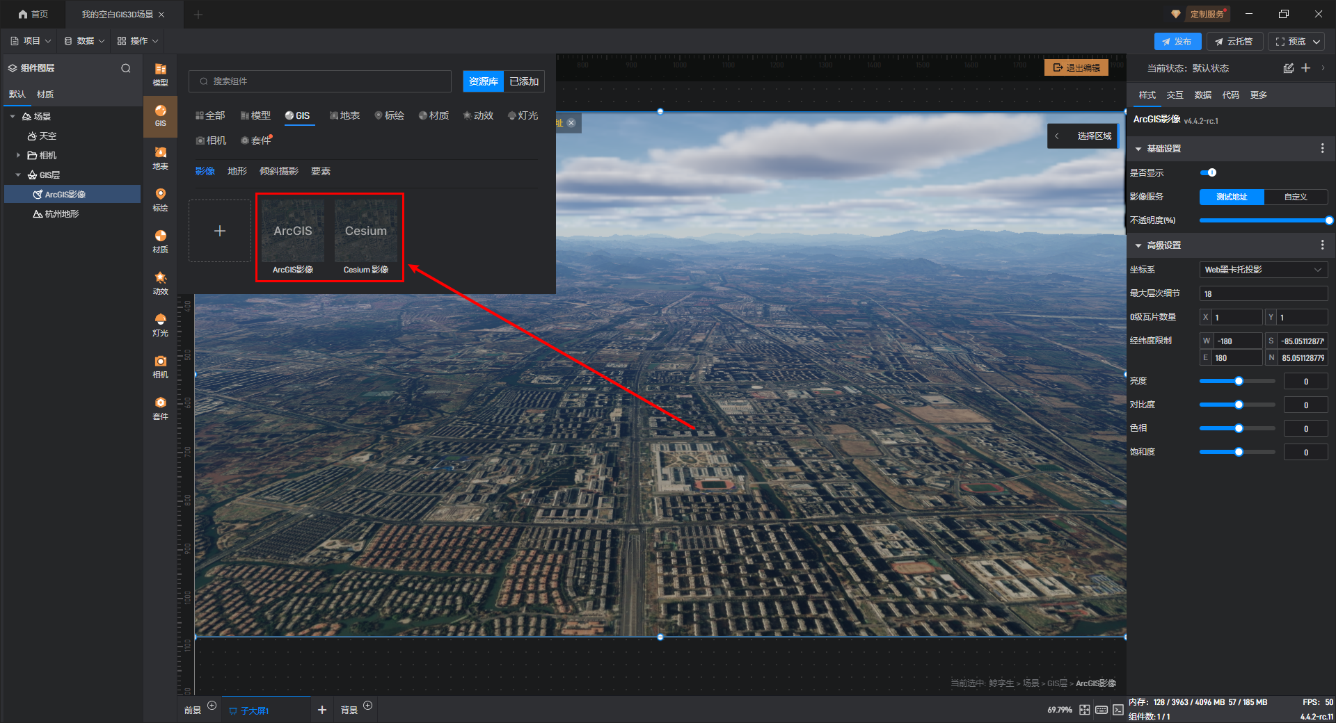
首先我们新建并打开一个“空白 GIS3D 场景”项目,双击进入鲸孪生的编辑状态,在左侧资源库中点击“GIS”,目前山海鲸提供两个默认的 GIS 影像,分别是“ArcGIS 影像”和“Cesium 影像”,如下图所示:
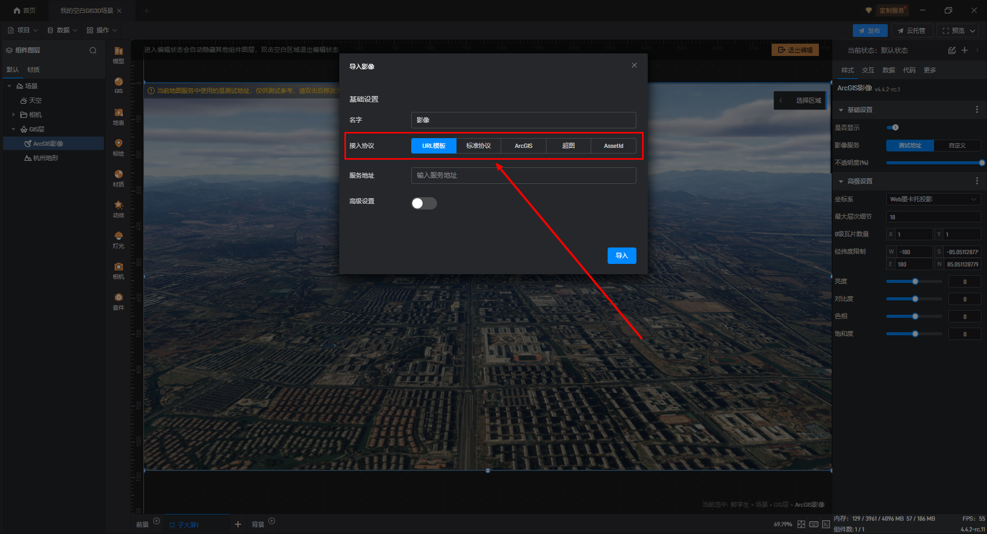
如果有测绘的 GIS 影像或其他来源的 GIS 影像,可以点击“影像”中的“+”按钮来添加。

分别是:“URL 模板”、“标准协议”、“**ArcGIS**”、“**超图**”、“**Assetld**”**等协议**,大家可以根据自己的需求进行选择,如下图所示:
【温馨提示】GIS 影像的自定义服务地址是通用的,经过切片处理后的 GIS 影像服务地址均可使用。
下面我们介绍一下较为常用的几个协议的接入方式,其他协议也可以参考这几种协议的接入:
1.1 URL 模板
这一个是一个通用的 URL 接入方式,当接入影像是自定义协议时可以使用这一项,也可以作为其他协议的替代方案,Url 模板支持以下参数的设置(来自 CesiumJS 的接口文档):
1 | {z}: The level of the tile in the tiling scheme. Level zero is the root of the quadtree pyramid. |
示例 URL 如下:
1 | http://{s}.basemaps.cartocdn.com/light_all/{z}/{x}/{y}.png |
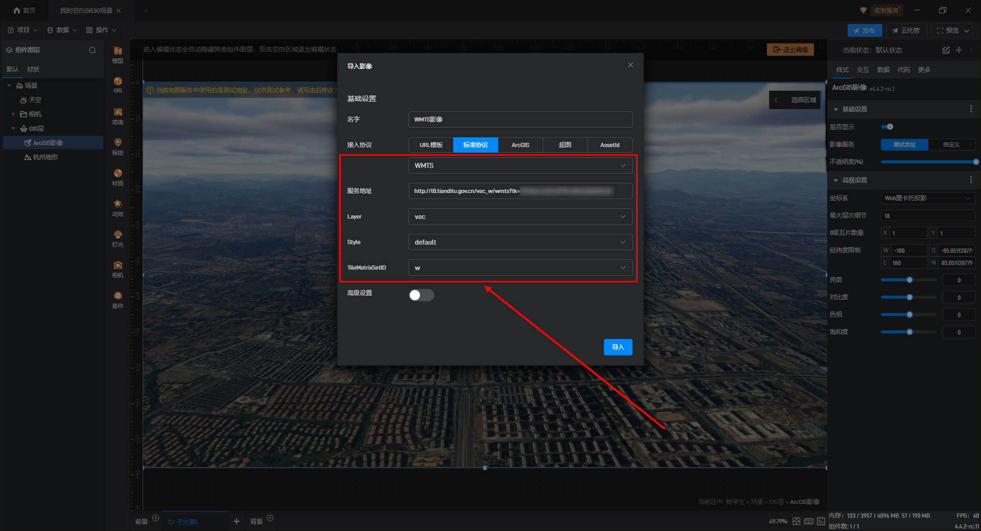
1.2 WMTS 协议
WMTS 是目前使用最广泛的底图接入服务,也是 OGC 的标准服务,具体协议的定义可以参考 OGC 官方文档。
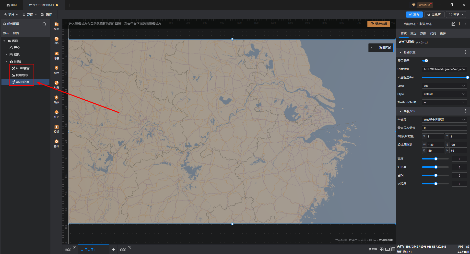
这里我们以天地图影像为例进行演示,选择标准协议中的“WMTS”,然后依次输入“服务地址”等相关信息。
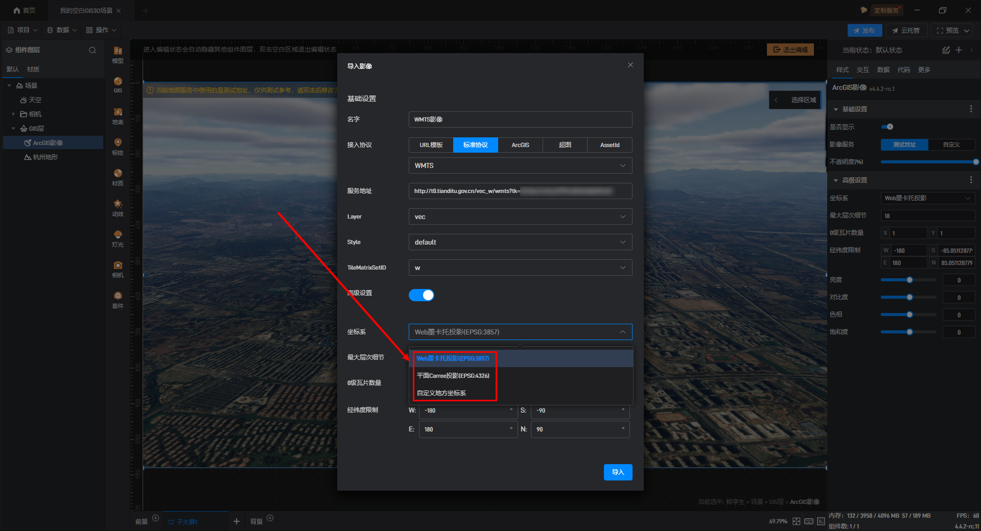
在下方我们可以开启“高级设置”,WMTS 协议中一些高级的设置如:“坐标系”、“最大层次细节”等设置都会自动从 Capabilities 中读取,就不需要主动设置了,下面简单介绍一下这些设置项。
需要注意的是,投影通常情况下都会选择“Web 墨卡托投影”,另一种是“平面 Carree 投影”,平面 Carree 投影就是我们平常所说的 WGS84 投影,如果需要使用非标准坐标系,也可以选择“自定义地方坐标系”。
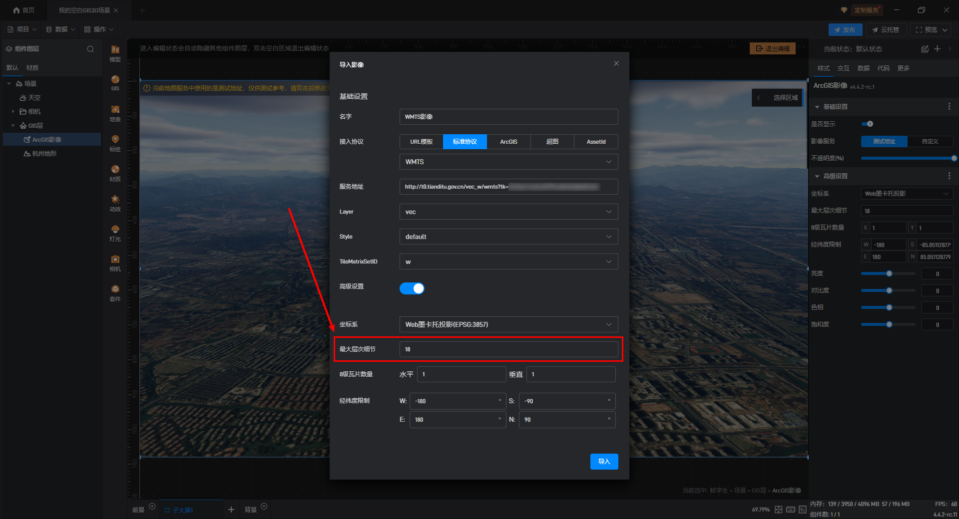
“最大层次细节”通常为 18,但部分较为精准的地图也可以达到 20,大家可以根据服务或自己测绘的情况来填写。
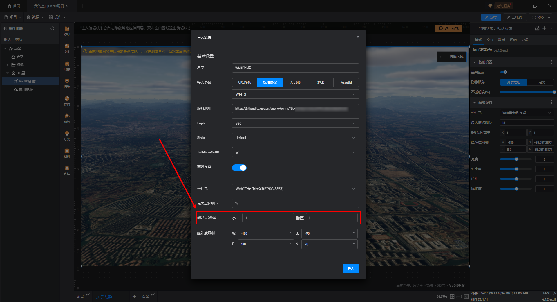
在网络地图瓦片服务(WMTS)中,“0 级瓦片数量”通常为 1 块,0 级是瓦片金字塔的最顶层,它代表了整个地图范围的最粗略视图,通常被表示为单个瓦片,覆盖整个地图区域。
如果我们的服务地址中包含整个地球的 GIS 影像,那么我们就不需要进行修改“经纬度限制”。如果只有部分 GIS 影像,那么此处可修改也可以不修改。
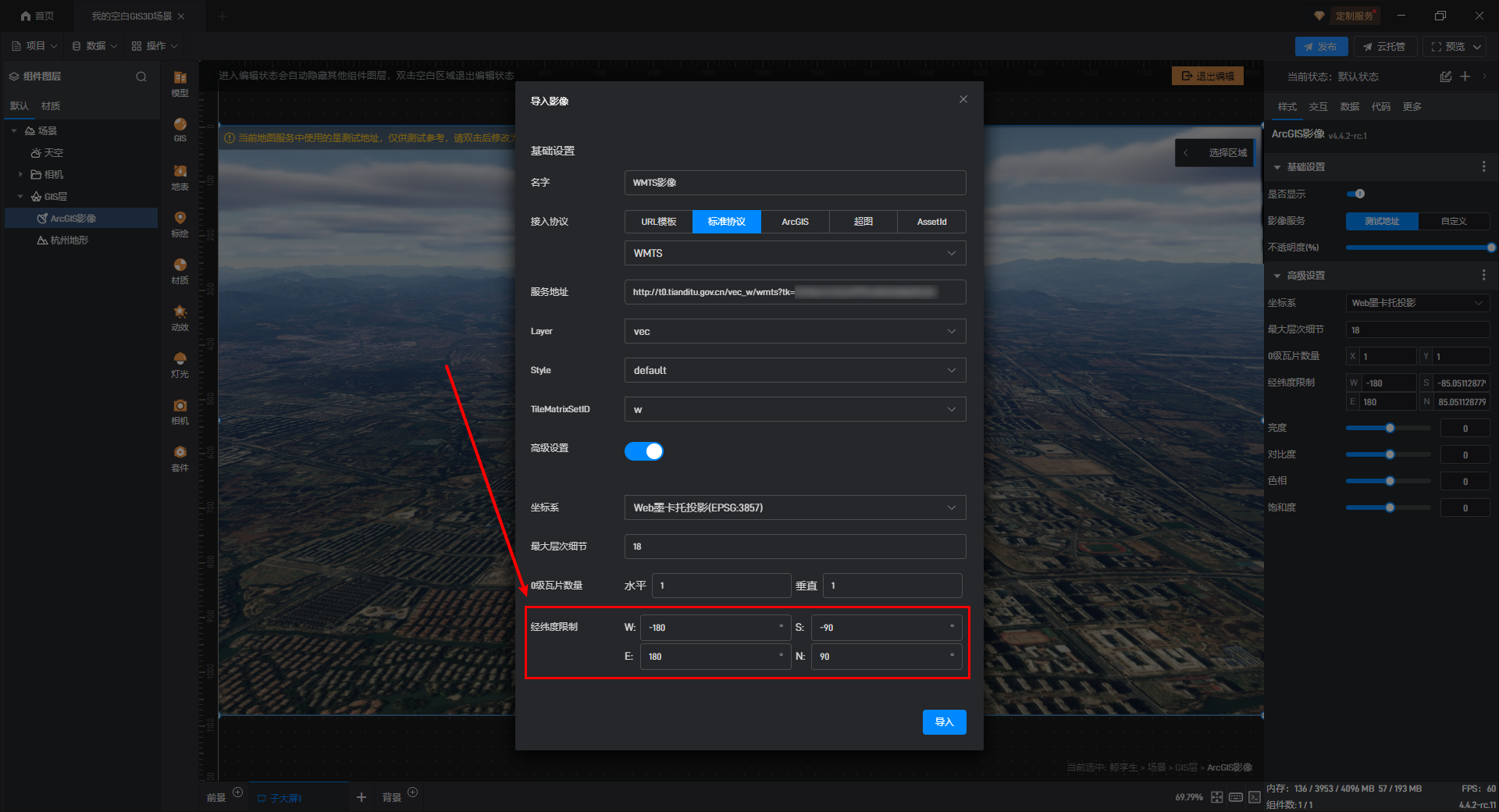
【温馨提示】如果不修改会导致超出边界的部分被访问到,导致该区域影像无法显示,但在整体体现上也不会存在问题,只会对性能造成一定影响。
设置完成后点击下方的“导入”按钮,就可以看到可以成功接入了:

2. GIS 影像的叠加
将 GIS 影像添加进去,新添加的 GIS 影像会叠加在默认 GIS 影像上方,覆盖旧的 GIS 影像,新添加的 GIS 影像图层位置处于默认 GIS 影像下方,如下图所示:
3. GIS 影像的样式
GIS 影像组件上的样式整体分为两大类,分别是基本设置和高级设置。下面逐个进行介绍:
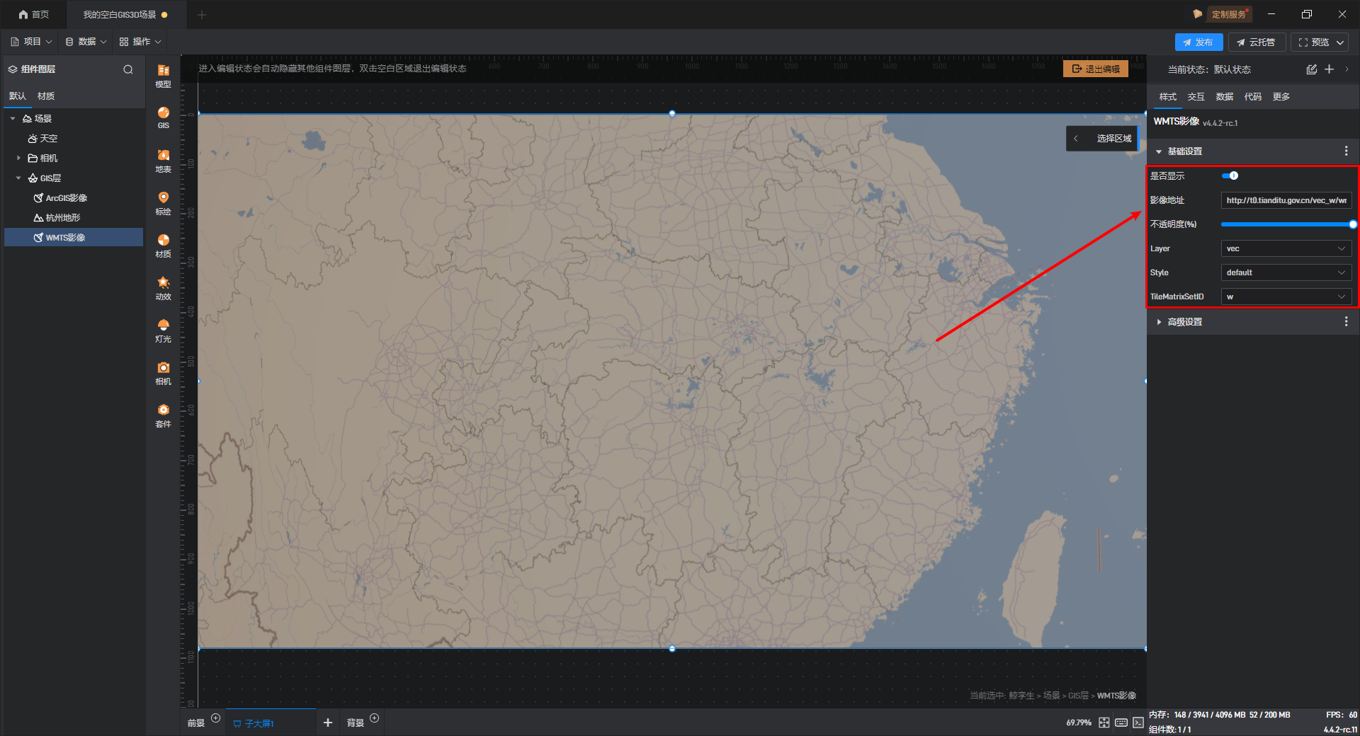
2.1 基本设置
| 配置项 | 说明 |
|---|---|
| 是否显示 | 是否显示 GIS 影像。 |
| 影像地址 | 可以在此处更改影像地址。 |
| 不透明度(%) | 可以自定义影像的不透明度 |
| Layer | 在 WMTS 中,一个 Layer 表示一组具有相同主题或类型的地理数据。例如,底图、卫星影像、交通信息等都可以作为独立的图层。 |
| Style | 定义了如何渲染一个图层的数据。它可以控制诸如颜色、透明度、符号化方式等视觉效果。 |
| TileMatrixSetID | 用来唯一标识一套瓦片矩阵设置的 ID。瓦片矩阵定义了如何将连续的地图划分为离散的小块(即瓦片),包括每个缩放级别的分辨率、原点位置以及瓦片大小等参数。 |
GIS 影像的基本设置,如下图所示:
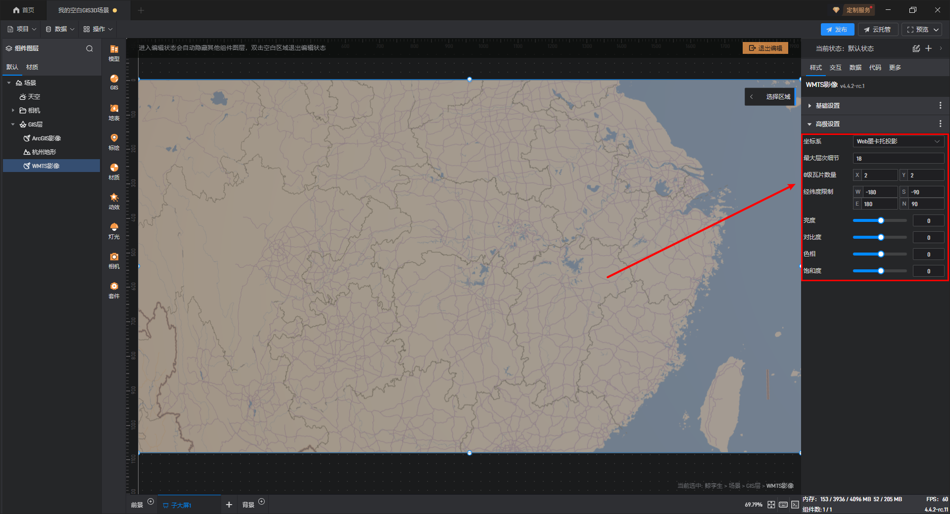
2.2 高级设置
| 配置项 | 说明 |
|---|---|
| 坐标系 | 可在此处选择 GIS 影像的坐标系投影为“Web 墨卡托投影”、“平面 Carree 投影”、**“自定义地方坐标系”**。 |
| 最大层次细节 | 层次细节越大,GIS 影像显示细节越丰富,占用性能越大。通常选用16-18作为层次细节,层次细节过小会导致 GIS 影像模糊,过大会导致 GIS 影像加载变慢。 |
| 0 级瓦片数量 | “0 级瓦片数量”通常为 1 块,0 级是瓦片金字塔的最顶层,它代表了整个地图范围的最粗略视图,通常被表示为单个瓦片,覆盖整个地图区域。 |
| 经纬度限制 | GIS 影像只会显示在该经纬度限制区域以内的模型。 注意选择Web 墨卡托投影后,南北的纬度限制会自动设置为 85 度 |
| 亮度 | 调整 GIS 影像整体亮度。 |
| 对比度 | 调整 GIS 影像整体对比度,使 GIS 影像中的黑白色彩对比更明显。 |
| 色相 | 调整 GIS 影像整体色相,偏向红色或偏向绿色。 |
| 饱和度 | 调整 GIS 影像整体饱和度,可以让 GIS 影像色彩更加暗淡或更加鲜艳。 |
GIS 影像的高级设置,如下图所示: